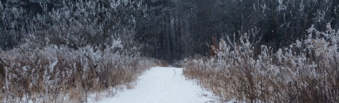

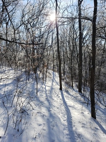
A few weeks ago when we experiencing that beautiful hoar/rime frost covering our trees I took some time to go up to the Miner Hill trails on what some people around here refer to as Tower Hill. If you want to learn more about Miner Hill you can go to our RC Tourism’s YouTube channel and watch, “Why do we call it that? Miner Hill”
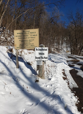
How to get there: Christy’s Sunnyside Cafe in downtown Richland Center is on Court Street and it is the perfect place to start your navigation. If her cafe is open, grab a beverage and cheeseboard to-go and have a picnic. Leaving Christy’s, you will drive up East Court street out of the downtown area, driving into a residential area for a few blocks until the road ends in a culdesac. The physical address is 700 block of East Court and it turns into Roosevelt Rd but you never actually see street sign for Roosevelt Rd. There is not a lot of public parking available at the base of Miner hill. Do not park in the culdesac at the end of the road but you can turn around in it and go back down Court street a block or so to the place of “allowed” parking. Be kind to the neighbors and respect the parking signs in this area.
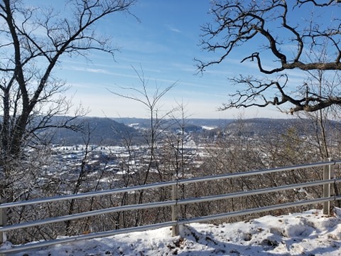
If you are wanting to snowshoe the trails, I actually suggest walking up the main driveway stretch in regular hiking/snow boots, and carry your snowshoes & pack. When you are almost to the top, you will see the picnic area and the first lookout point and railing. The views and lookout points on top of the hill are beautiful and it is worth the climb. You start out in the culdesac around 820 feet above sea level and climb until you reach the top at 1080 feet above sea level. The incline, until you get to the picnic area, is pretty sharp. The driveway is usually plowed regularly and closed to public vehicle traffic.
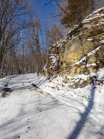

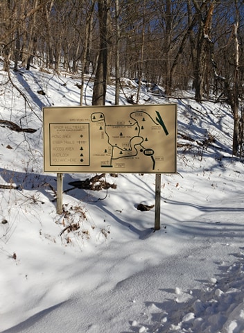
There is a hiking trail that branches off the driveway to your right as you make your climb up the hill. On the city park map/brochure it is the purple trail called the “east trail.” It is a great trail to hike in the summer but I found it difficult to snowshoe. I prefer the trail on top of the hill called the “Quarry Flat trail and North Woods trail.” You can access the city park map/brochure here:
You can also learn more about the trail by looking at this link on All Trails-
https://www.alltrails.com/trail/us/wisconsin/tower-drive-trail-and-north-woods-trail?ref=result-card
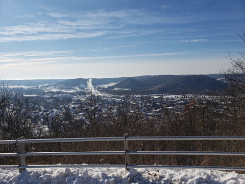
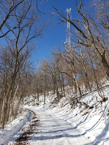
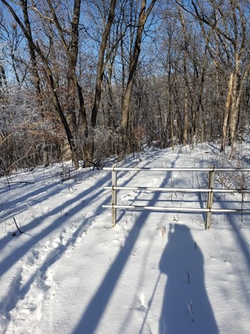
Once you see the picnic table, you can stop and use the benches to get your snowshoes on. You will still need to climb a little more ascent but it is much more doable in snowshoes. You will continue on the driveway path and go past another lookout point railing over the city. This is a great time to take some pictures of the whole valley and city. You will see where the old Mill pond used to be and the Pine River as it snakes thru town.
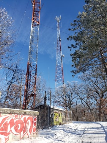
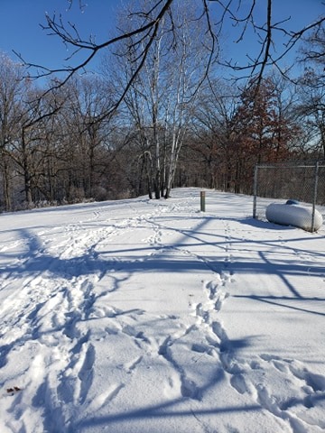
You will see a bit of graffiti on some outbuildings and then see all the radio towers. Go beyond the towers to the back right corner. Generally, you will see the footsteps of others that have gone there before you.
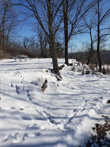
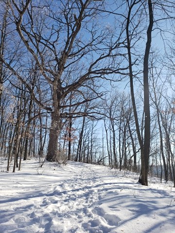
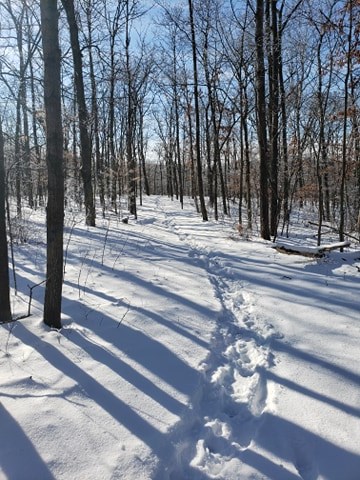
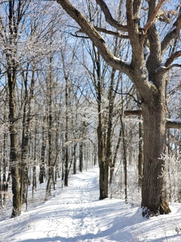
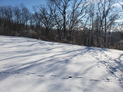
Once you enter the woods, it is just magical. The wooded area is managed nicely and there are very few brambles to contend with. The tree canopy even in winter feels like a protective covering overhead. The trail is wide enough for snowshoeing and it is obvious where to go as the path is clear thru the trees. Continue to follow the trail and you will come out on top into a field/pasture area. I turned around at that point and did an out & back into the woods again and connected with the trail returning to the towers. There is another lookout point railing as well, giving you a city view in another direction.
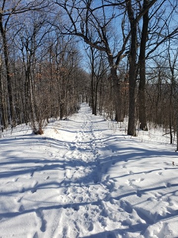
It won’t take too long to snowshoe the forest trail and I did the climb up the driveway, down the driveway, and snowshoe the forest trail in about an hour. All in all, a great workout! You will have good cell service up there. The trail is well-maintained. This experience does require some moderate physical exertion so make sure to check with your physician to clear you for physical activity. This trail usually has a little more snow than in the valleys but conditions can vary on our ridges and valleys. There are no garbage cans available so carry-in & carry-out, please.
If you have any comments or pointers you can add to this post, please send me an email at ridgeandvalleytours@gmail.com and I would be happy to edit. I plan to have a webpage with all of our local public trails perfect for snowshoeing coming soon.
The weather this week is a bit colder than last week and it looks like our next chance for snow is Saturday, January 23. Our current snow conditions are sketchy on some trails as we have had some melting last week. Hilltops are currently better than valleys, especially if they are on the north side.
